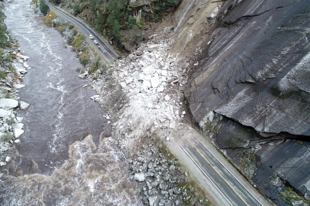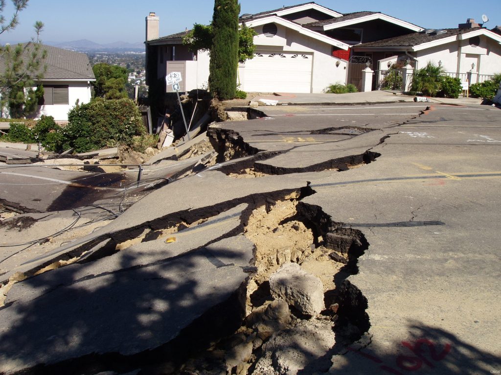
Landslides are a perennial threat in California, where the geology and steep topography mean the land is more prone to slipping than in other places.
Now, researchers at the University of Texas Institute for Geophysics and UC Santa Cruz studying two large Northern California landslides think they’ve found the key to predicting landslide motion hidden in the very rocks where they happen. And it’s thanks — in part — to earthquake science.
Published Oct. 16, 2024, in Science Advances, the researchers found that much of the physics and geological factors behind California’s earthquakes and landslides are the same. By applying earthquake rules to landslides, the researchers believe they have a technique that can predict how easily — and how fast — a surface will slide when rainfall increases.
The key to figuring out the connection was in the type of rock where the landslides form. The California Coast Ranges are a mélange of rocks with different characteristics, beaten up to varying degrees over eons of tectonic movement. When the rock is clay-like and soft, the land surface moves easily but slowly, shifting a few inches or feet over a matter of weeks. Harder rocks, however, are less able to move, allowing strain to build, and leading to faster, more catastrophic landslides when the earth does finally fail.
“Gravity will always win,” said co-author, Demian Saffer, director of UTIG. “It’s just a question of whether it wins in a split second or whether it wins over the long term.”

The research was first reported by UC Santa Cruz Science.
California experiences frequent destructive landslides. In September 2024, hundreds of residents in Rancho Palos Verdes were told to evacuate when a massive landslide slowly tore apart their Southern California city. The land movement had steadily worsened after historic storms earlier in the year. The new study could help communities know when rainfall and other events are likely to raise the risk of future slides.
“This study provides us with a framework for understanding how much motion to expect based on a change in rainfall, which leads to a change in water pressure in the ground that then translates into motion,” said the study’s lead author Noah Finnegan, a professor of earth and planetary sciences at UC Santa Cruz.
The breakthrough came when the researchers set out to see whether measuring a landslide could reveal the underlying rock physics, in effect treating it as a real-world lab experiment — the kind that earthquake scientists run on individual rocks pulled from earthquake faults but on a much larger scale. They took recent data on land movement and other environmental observations for two long-running Northern California landslides and used it to correctly calculate the characteristics of the rocks underlying the landslides. They then tested the same idea on another landslide dating back to the early 1980s, with similarly successful results.
According to Saffer, developing a landslide hazard map could be as simple as running the calculations in reverse: Analyzing a location’s rocks can determine its landslide potential.
“If you can make targeted measurements of rheology (the rock’s behavior and how it fails) in laboratory experiments, combining this with geologic mapping would allow a prediction of responses to rainfall, or even earthquake-induced shaking, highlighting high and low risk zones for rapid versus creeping landslide hazards,” he said.
Saffer and Finnegan are looking to test and refine their model in other terrains where other rock types are prevalent.
The research was funded by the National Science Foundation.
For a deep dive into the science behind the research read UC Santa Cruz’s story: Understanding landslides: a new model for predicting motion.
For more information, contact:
Constantino Panagopulos, University of Texas Institute for Geophysics, 512-574-7376
Anton Caputo, Jackson School of Geosciences, 210-602-2085
Monica Kortsha, Jackson School of Geosciences, 512-471-2241
Julia Sames, Department of Earth and Planetary Sciences, 210-415-9556.
