Speaker: James Thompson, Research Assistant Professor, Bureau of Economic Geology, University of Texas at Austin
Host: Danielle Touma
Title: High-Resolution Infrared Remote Sensing of Geohazards from Volcanoes to Wildfires
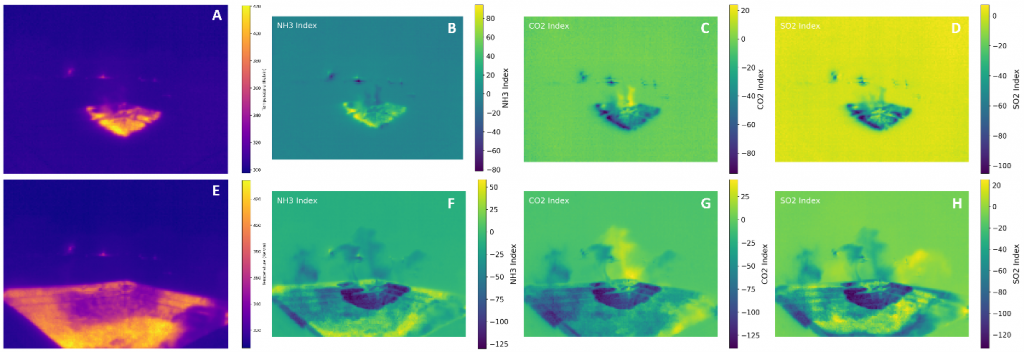
Abstract: How can recent improvements in the spatial and spectral resolutions of infrared remote sensing datasets enhance our ability to observe and analyze geological hazards (volcanoes and wildfires)? Will a more accurate quantification of thermodynamic processes across scales (mm to km) improve our interpretations of pre-, syn-, and post-hazard influences and feedbacks? Over the last few decades, resolution improvements of infrared remote sensing data have enabled observations at smaller scales previously unattainable, providing the detail necessary to advance hazard models and surface process interpretations (e.g., lava flow propagation dynamics and wildfire front convective dynamics). These improvements lead to a better understanding of hazard feedbacks and risk assessments for both populations and ecosystems. For our volcanic work, we show how new ground and airborne (both Crewed and Uncrewed Aerial Systems) multispectral thermal infrared instruments are used to observe subtle variations in heat flux and crustal development in lava flows, which were later used to improve runout distance models and more accurately predict risks to local populations. These systems are also deployed to wildfires to characterize the dynamics of fire fronts to increase understanding of heat flux, which can significantly influence spreading rates and the overall restoration of the landscape. Further, data from infrared instruments are used to improve estimations of gas fluxes from both volcanoes and wildfires, with implications for localized microclimate variability and health impacts on populations. Finally, these high-resolution observations are both (1) scaled to satellite observations to provide more wholistic interpretations of the hazards and (2) compared with other observations (e.g., soil physics, meteorology, flora characteristics, morphology) to identify positive and negative feedbacks within the terrestrial processes. The results provide a discernable increase in accuracy of thermodynamic models and insights into thermal and gas fluxes influences on landscape conditions.