
Geoscience field trips can be grueling and – without the right preparation – hazardous. Research sites are often miles away from civilization, accessible only by foot or helicopter. For many, however, being surrounded by nothing but untouched nature is reward in itself.
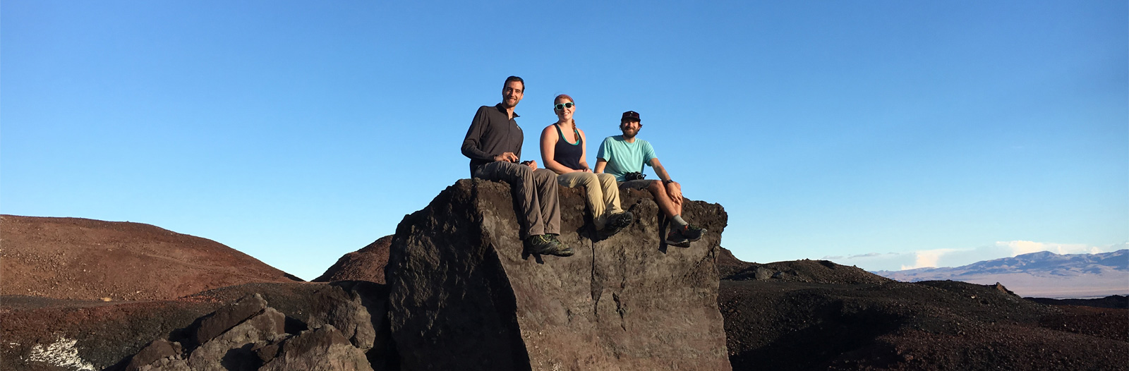
The trip to service the Mojave Broadband Seismic Experiment began on October 10 and took five days to conclude. Each day typically involved a 15-20 mile hike through rocky, unmarked terrain. UTIG graduate students Kelly Olsen, Brandon Shuck and Simone Puel who were on the sensor-servicing team shared their favorite moments from the trip.
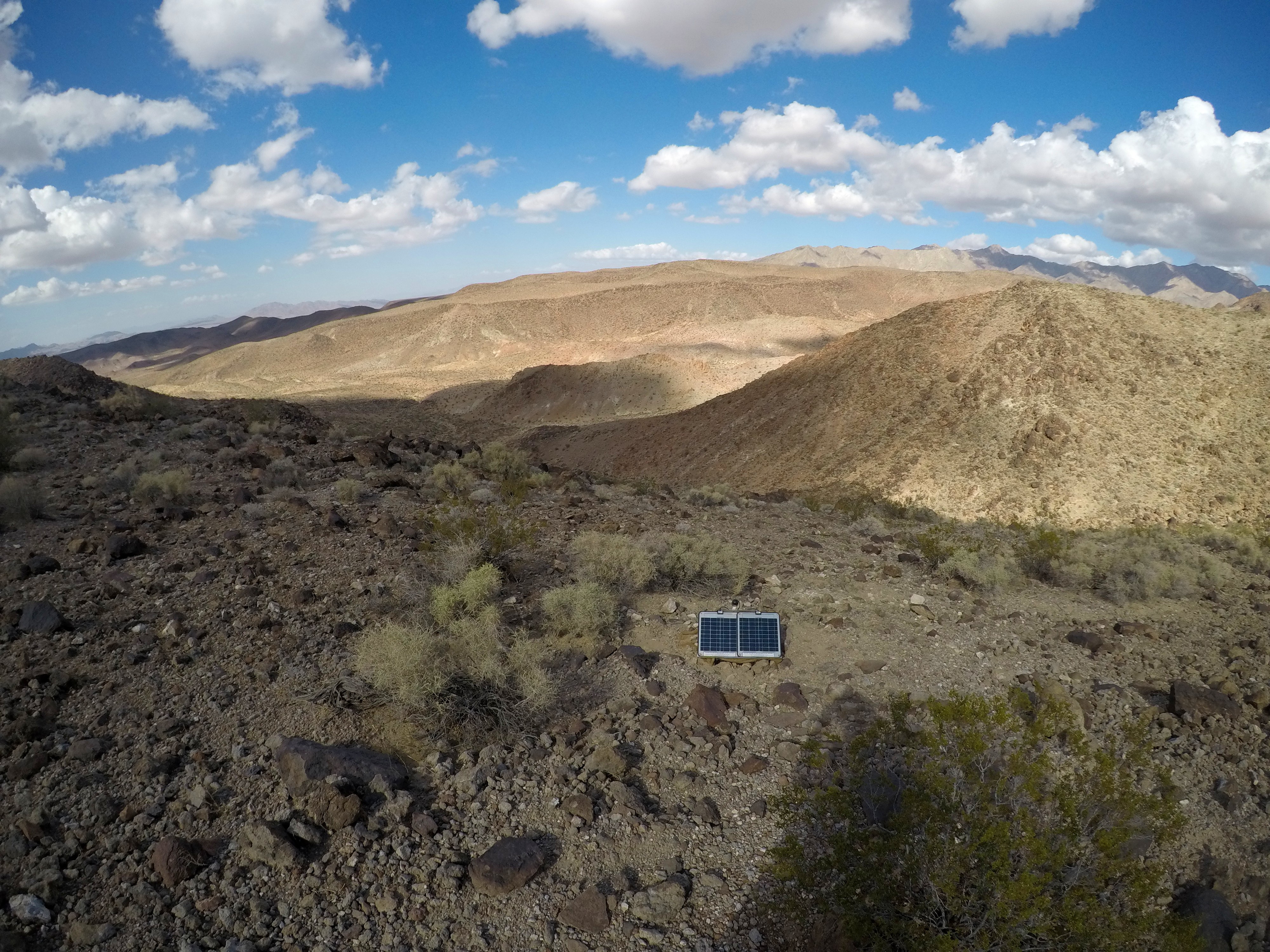
This is seismic station MOJP. This picture was taken the second day we were in the field. I was teamed with Kelly that day and we were tasked with visiting three stations in a 16 km (10 mile) loop. It was our first day working alone as a team so I remember feeling anxiety about getting everything right. I love this picture because it reminds me of that first day. The station was so remote and far from civilization few people could have visited there before us in modern times. I really felt a special kind of quietness in this place. We were just us and nature. It was awesome!Photograph: Simone Puel, 2018
“The systems are simple and very easy to use,” said Puel. “Our role was to download data, check the systems and apply any fixes or additional protection.”
Simone spent a lot of time in the field when he was a geology undergraduate, including the Alps and Mount Stromboli in his native Italy. However, there was something unique about the Mojave Desert.
“The experience of going to the desert and seeing nature so untouched is very special. More than anything you feel the quietness – it’s really a unique experience.”

This desert tortoise belongs to an endangered species – sightings in the desert are rare. This picture was taken on the last day. We had finished downloading data from all 19 stations in just four days. However, on the last trip we had discovered one of the sensor’s GPS cables had been damaged (the sensor relies on GPS to accurately record data). Our team leader Rob, decided we should add additional protection to all GPS cables in the form of foam pool noodles. So we spent the final day of the trip attempting to reach every single station we’d spent the last four days visiting. That day I was teamed with Rob and we did eight stations in about seven hours. We found the tortoise at the end of the day as we were returning from the last station. We were so happy and felt so lucky to have seen this rare, endangered animal.Photograph: Simone Puel, 2018
Olsen and Shuck are both marine geophysics students. As the sensor stations were deployed in remote locations far from the “noise” of human activity, servicing the stations involved challenging hikes of up to seven hours across mountainous terrain.
Olsen said,
“The Mojave Desert field trip was very different from the fieldwork I normally do. It was much more physical work but at the same time much more peaceful. There’s a lot that can go wrong on a boat so you have to be alert all the time, making sure you are fixing things in real time. This kind of trip lets you think more carefully about where you are and what you are doing. There’s a lot of hiking involved though. I’m not sure you’d do this if you didn’t like hiking!”
Here we see two lithologies merging together between two sites, L and K. Brandon and I hiked 15 miles on this particular day and saw at least fifteen different types of rock!Photograph: Kelly Olsen, 2018
“Getting to see the regional geology close up was a special experience,” said Brandon. “There’s so much going on, geologically speaking. But to really understand the geology and see the detail you need instruments like the ones we were servicing. It’s very cool that we were part of this.”
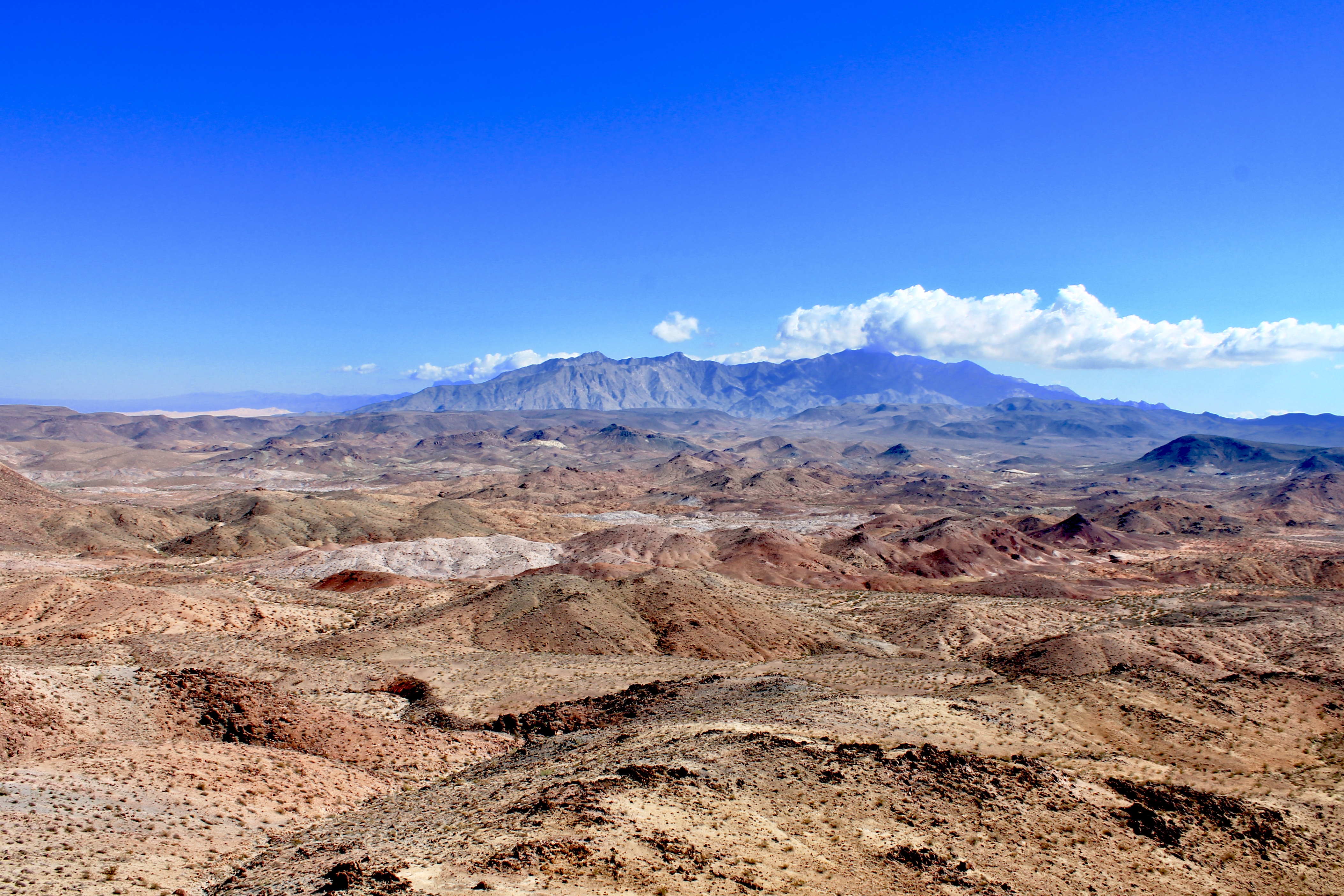
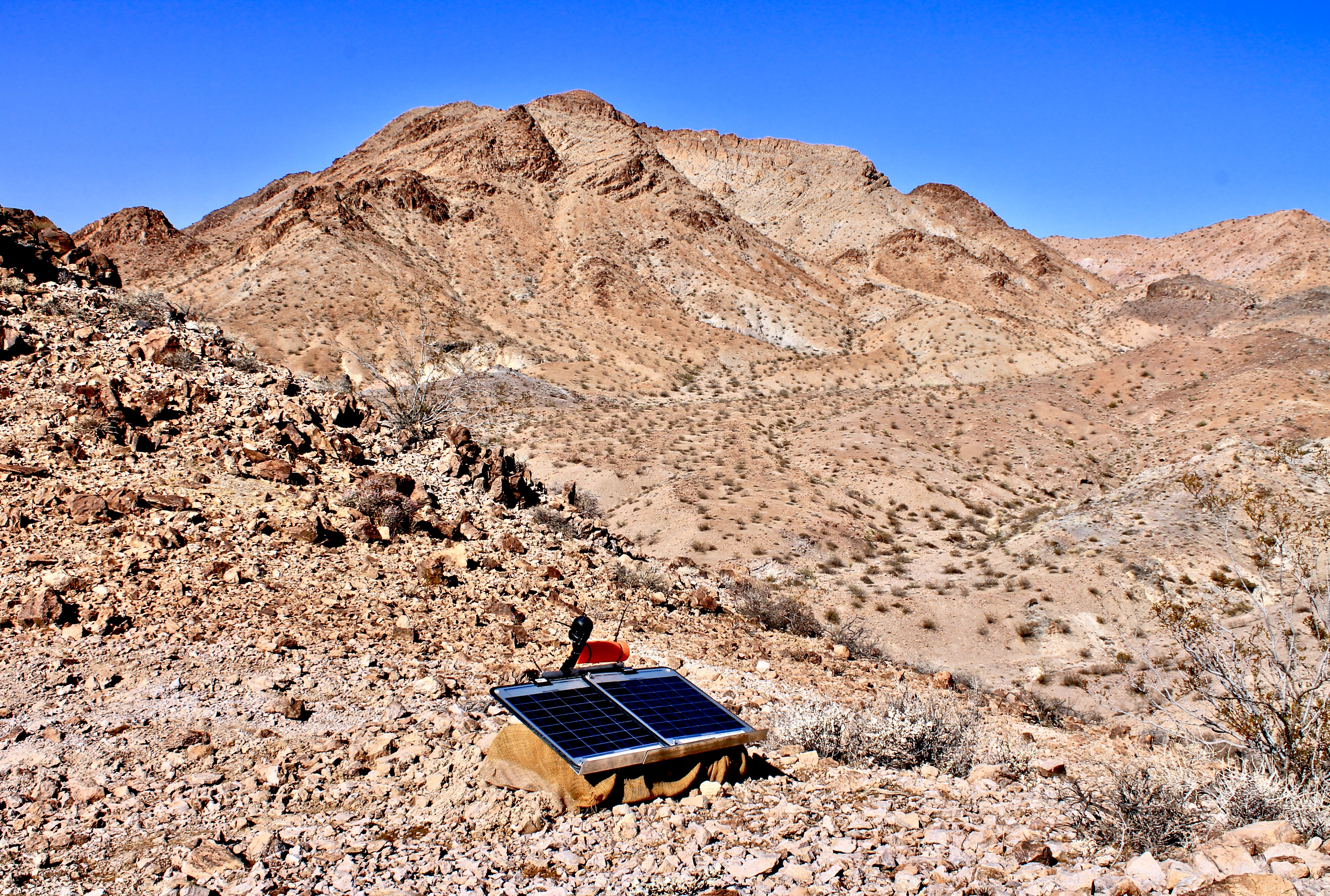
Stunning landscape of the Mojave desert with the prominent Granite Peak in the background. We stumbled upon this breathtaking view after climbing a large hill between stations L and M. The colorful rolling hills in the foreground are composed of different geological units which makes the hike between stations very exciting.Photograph: Brandon Shuck, 2018
Seismometer J planted into a hill of rhyolite. If you look closely, you can see massive folds within the mountains in the background.Photograph: Brandon Shuck, 2018