Background
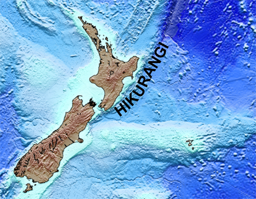
The Hikurangi margin lies along the eastern edge of the North Island of New Zealand, where the Pacific plate subducts beneath North Island.
The Hikurangi Subduction Zone is an important location for scientific research of plate tectonics and earthquake seismology. GPS data show a transition in slip behavior from predominantly stick-slip in the south to aseismic creep in the northern North Island. More geological and geophysical data are needed to understand what characteristics of the tectonic plates may cause such along-strike variations in subduction-related processes. You can watch a short video about New Zealand’s largest fault zone courtesy of GNS Science.
In 2016, scientists from the United States, New Zealand, Japan and the United Kingdom started collaborating on two major seismic studies of the Hikurangi margin to evaluate the geological conditions that govern the style of slip and other long-term deformation. To investigate the feedbacks between deformation, fluid flow and solid mass fluxes, results from seismic data analysis will be integrated with geological field studies of landscape evolution, paleoseismology, and geodynamical modeling of subduction zone processes. In 2017, proposed scientific drilling expeditions offshore the Hikurangi margin would provide important data and logging measurements from drill holes into the subduction megathrust and the incoming sediments.
Useful Links
Hikurangi Subduction Earthquakes and Slip Behavior – GNS project website
IODP (International Ocean Discovery Programme)
IODP Fact Sheet on the Hikurangi Project
IODP Fact Sheet on Scientific Drilling
GeoPRISMS Office, New Zealand
IODP drilling expedition 372: Creeping gas hydrate slides
IODP drilling expedition 375: Hikurangi subduction margin
Contact Us
For general information, contact:
Gail Christeson
University of Texas Institute for Geophysics
J.J. Pickle Research Campus, Bldg. 196
10100 Burnet Rd. (R2200)
Austin, TX 78758-4445
gail@ig.utexas.edu

