

When the Baja California peninsula broke from mainland Mexico nearly 12 million years ago it gave rise to the Gulf of California. New research suggests that this process of continental rifting was greatly accelerated due to tectonic forces on the opposite side of the Pacific Ocean. The finding comes from a study published in Science,… Continue Reading Faraway tectonic forces may have accelerated the Gulf of California rifting
UT Geodynamicist Thorsten Becker elected to German National Academy of Sciences

Thorsten Becker, a professor at The University of Texas at Austin Jackson School of Geosciences, has been elected a member of the German Academy of Sciences, Leopoldina, one of the oldest and most prestigious academies of science in the world. Becker joins as only one of three geodynamicists to be elected to the organization in its over 370-year history. “It is a great honor to be elected… Continue Reading UT Geodynamicist Thorsten Becker elected to German National Academy of Sciences
How Activity in Earth’s Mantle Led the Ancient Ancestors of Elephants, Giraffes, and Humans into Asia and Africa

What roils beneath the Earth’s surface may feel a world away, but the activity can help forge land masses that dictate ocean circulation, climate patterns, and even animal activity and evolution. In fact, scientists believe that a plume of hot rocks that burst from the Earth’s mantle millions of years ago could be an important… Continue Reading How Activity in Earth’s Mantle Led the Ancient Ancestors of Elephants, Giraffes, and Humans into Asia and Africa
North America is Dripping from Below, Geoscientists Discover
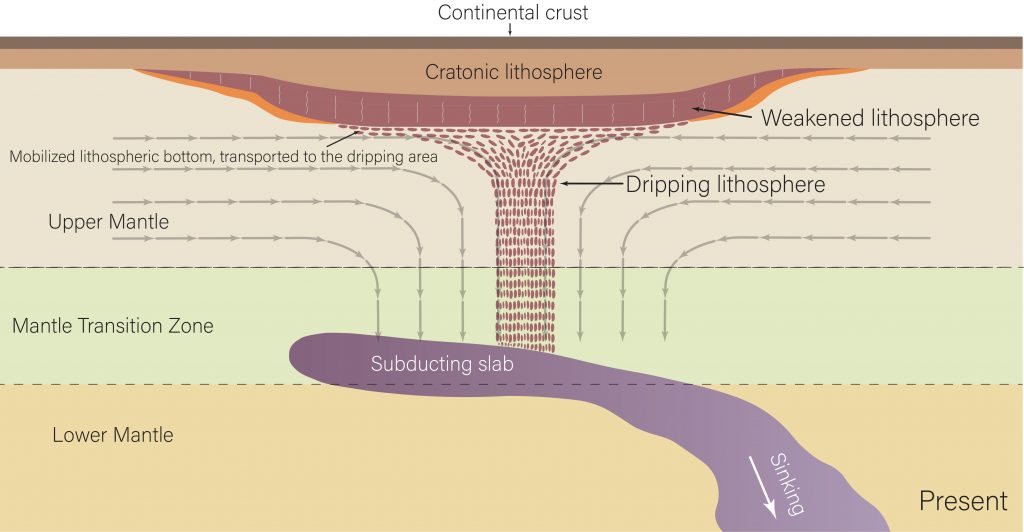
Researchers have discovered that the underside of the North American continent is dripping away in blobs of rock — and that the remnants of a tectonic plate sinking in the Earth’s mantle may be the reason why. A paper published in Nature Geoscience describes the phenomenon, which was discovered at The University of Texas at… Continue Reading North America is Dripping from Below, Geoscientists Discover
New Imaging Technique Uses Earth’s Warped Surface To Reveal Rocky Interior
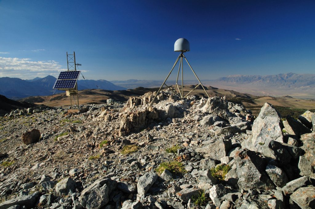
Surface mapping technology such as GPS, radar and laser scanning have long been used to measure features on the Earth’s surface. Now, a new computational technique developed at The University of Texas at Austin is allowing scientists to use those technologies to look inside the planet. The new technique, described by researchers as “deformation imaging,”… Continue Reading New Imaging Technique Uses Earth’s Warped Surface To Reveal Rocky Interior